Land Survey
- Home
- Land Survey
All Services
Need Emergency Construction Services?
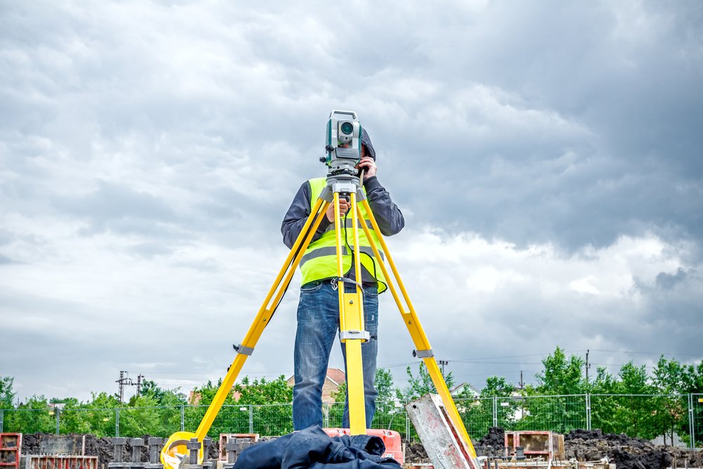
Best Property land survey in Delhi NCR
Understanding land, boundaries, and terrain is no longer optional. Whether you are planning construction, buying property, starting an industrial project, or managing urban development, you need accurate mapping that helps you make decisions with confidence. Our Expert Land Survey and Mapping Services in Delhi offer the perfect blend of modern technology and experienced field expertise, ensuring every client receives the clarity they need before taking the next step.
We provide advanced surveying solutions using DGPS, Total Station, Drone Survey, Aerial Mapping, Boundary Survey, and Topographic Survey, designed for individuals, builders, architects, real estate developers, government bodies, and industries across Ghaziabad and Delhi NCR. Every survey is carried out with careful planning, precise instrument handling, and thorough data validation to ensure dependable results you can trust.
Our team focuses on delivering reports that are easy to read, technically accurate, and aligned with industry standards. From identifying land encroachments to understanding elevation profiles, from creating digital maps to supporting government documentation, we handle each requirement with professional responsibility and attention to detail. With reliable turnaround time and complete transparency, we help clients move forward with clear information and full confidence in their project.
Our Core Services
1. DGPS Survey in Delhi NCR
A Dual Frequency GPS (DGPS) Survey provides extremely high-accuracy coordinates essential for large projects. We perform DGPS surveys for:
Industrial land, Plots and farms, Road and highway planning, Government tenders, Environmental mapping, Construction and infrastructure development
DGPS helps you eliminate boundary disputes, get exact land coordinates, and create legally sound land records.
2. Boundary Survey
Our Boundary Survey service is designed to identify exact property limits. This helps property owners avoid: Encroachments, Boundary conflicts, Legal disputes, and Construction penalties You get a clear map marking the exact edges of your property, suitable for registry, approvals, and construction planning.
3. Topographic Survey in Ghaziabad
A Topographic Survey shows the natural and man-made features of land, including elevations, slopes, drainage patterns, and obstacles. This is essential for:
Architectural planning, Land development, Urban design, Road alignments, Civil engineering projects
We combine Total Station and Drone data to create accurate topographic maps that help you plan safely and efficiently.
4. Aerial and Drone Survey
Our Drone Survey service delivers fast and highly detailed mapping for large and complex projects. Benefits include:
High-resolution aerial images, Accurate 3D terrain models, Faster project completion, Minimal human errors
Drone surveying is perfect for industrial sites, real estate projects, quarries, farmlands, and government infrastructure projects.
5. Total Station Survey
Using advanced Total Station equipment, we carry out:
Construction layout, Plot measurement, Road alignment, Leveling, As-built surveys
This ensures millimeter-level precision, helping you stay compliant with architectural drawings and engineering requirements.
Industries We Serve
We support a wide range of sectors, such as:
Real estate developers, Industrial estates, Manufacturing units, Government departments, Architects and planners, Infrastructure companies, Individual property owners, Logistics and warehouse projects. Whether you need land measurement for a small residential plot or a large industrial zone, we tailor the service to your needs.
Our Process: How Your Survey Gets Completed
1.Understanding Your Requirement
2. Field Survey with Advanced Tools
3. Data Processing and Mapping
4. Delivery of Final Survey Report
5. Final Certification
Why Choose Us for Land Surveying in Delhi NCR
Choosing the right surveying partner can save you time, money, and countless headaches. Here is why clients across Delhi NCR trust us:
1. Modern Equipment, Accurate Results
We use industry-leading tools such as DGPS, Total Station, Drones, and GIS Mapping Software to deliver the highest level of measurement accuracy. This ensures every report is reliable and accepted by architects, engineers, and regulatory bodies.
2. Detailed Reports That Are Easy to Understand
Survey reports should simplify your planning, not confuse you. Our deliverables include: Boundary maps, Digital survey drawings, Point data, 3D terrain models, and Elevation profiles. Everything is presented in a clean, easy-to-read format so you can make decisions confidently.
3. Experienced Team With Strong Regional Knowledge
With years of experience working in Delhi, our team understands local land records, terrain challenges, authority requirements, and project expectations. This makes your entire process smoother and faster.
4. Fast Turnaround Time
Most surveys are completed within:
24 to 48 hours for small plots
2 to 5 days for large industrial or commercial land
5. Trusted Across Delhi NCR
Builders, developers, industries, architects, and government bodies across Ghaziabad, Noida, Delhi, Greater Noida, and Faridabad consistently rely on us for clear and precise land surveying.
Commonly Asked Questions
Most residential plots take 24–48 hours. Larger commercial or industrial sites may take 2–5 days depending on complexity and area size.
We use DGPS, Total Station, Drones, aerial mapping systems, and GIS software to ensure accurate and modern survey outputs.
Yes. We deliver CAD files, GIS layers, KML files, 3D models, and PDF maps that are compatible with all planning and engineering software.
Drone surveying is best for medium to large sites. For small plots, Total Station or DGPS is more suitable and cost-effective.
Yes. A boundary survey can help clarify boundaries and provide legal documentation that can be used for dispute resolution or verification.
Survey cost depends on land size, terrain, and the type of survey required. Contact us for a customized quote.
Yes. Our survey reports comply with industry standards and are accepted by municipal authorities, architects, and engineering teams.
Absolutely. We survey agricultural plots, village land, farmhouses, and large rural properties.
Yes. Our topographic surveys include complete elevation profiles and contour maps for accurate planning.
Yes, upon request we provide high-resolution images, videos, and aerial maps for projects.
Frequently Searched Links
- Best Construction site surveying Ghaziabad
- Top Land surveying company in Ghaziabad
- Best Boundary marking survey in New Delhi
- Top Construction site surveying Ghaziabad
- Best Plot measurement service in Haryana
- Professional land surveyor in Noida
- Certified land survey services in Gurugram
- Best land survey near me
- Top drone survey in Faridabad
- hire land surveyor delhi ncr
- plot survey near me
- Contact Us